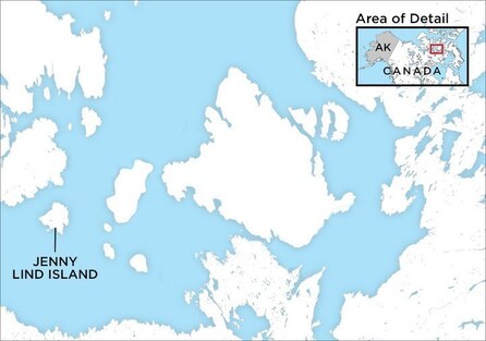
 Jenny Lind Island: 68°43′N 101°58′W.
 Some great musicians have had statues erected in their honour. Some have concert halls and music conservatories named after them. Still others are memorialized on postage stamps and in street-names. But how many can lay claim to an island in the Canadian Arctic?
According to the good folks at Wikipedia, Jenny Lind Island is “a small island 420 km2 (160 sq mi) in the Kitikmeot Region of Nunavut, Canada. The island is located in the Queen Maud Gulf, about 120 km (75 mi) southeast of Cambridge Bay.”
According to the good folks at Wikipedia, Jenny Lind Island is “a small island 420 km2 (160 sq mi) in the Kitikmeot Region of Nunavut, Canada. The island is located in the Queen Maud Gulf, about 120 km (75 mi) southeast of Cambridge Bay.”
The article goes on to explain that the island “is named for the Swedish born opera singer, Jenny Lind” – but I’m guessing you already figured that out.
According to another website (www.ibacanada.org), Jenny Lind Island “is situated in the Queen Maud Gulf, southeast of Victoria Island in Nunavut. Some parts of the island consist of flat terrain, whereas other parts of the island consist of undulating terrain that is interspersed with sparsely vegetated rocky ridges. The remainder of the island contains numerous low-lying wetlands and sedge meadows. The shoreline is mostly sandy. A tiny herd of Muskoxen live on the island.”
To find out how the island came to bear Lind’s name, a little more research was needed. Apparently, Jenny Lind Island was called as such by John Rae, a British explorer who poked around in the Arctic in 1840s and 1850s. He is credited with finally figuring out exactly where the Northwest Passage lies – and he also acquired evidence and information relating to the lost Franklin expedition.
As for why Rae chose to name this particular island after Lind, one can only presume that he was a fan of the “Swedish Nightingale.” And since Lind lived until 1887, it is entirely possible that she knew there was an Arctic island that bore her name.
Today, the island has no permanent human inhabitants. However, from the 1950s to the 1990s, it was the site of the CAM-1 radar station in the Distant Early Warning Line –the “DEW Line,” as it was called. There’s also an airstrip called Jenny Lind Island Airport.
© Colin Eatock 2019
 RSS Feed

